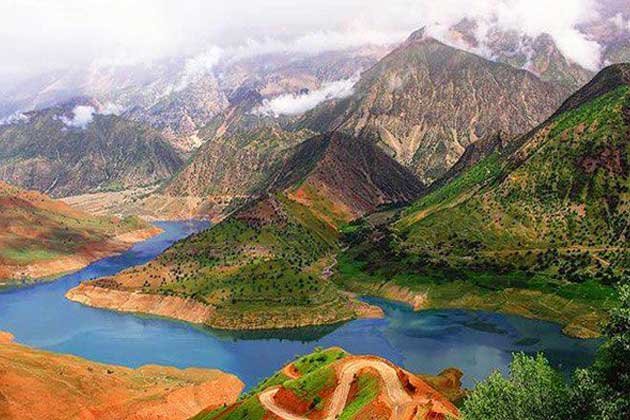
The Zagros Mountains are one of the most important and strategically significant mountain ranges in the Middle East. Stretching approximately 1,500 kilometers from southeastern Turkey through northern and western Iran to the Persian Gulf, this range forms a dominant physical barrier in the region. It is the largest mountain chain in both Iran and Iraq and has shaped the geography, history, and defense strategies of the area for thousands of years.
The formation of the Zagros Mountains is the result of the collision between the Arabian and Eurasian tectonic plates. This ongoing geological activity has created folded sedimentary rocks, primarily composed of limestone and shale. The range features rugged peaks, deep valleys, and high plateaus, with some peaks rising over 4,000 meters above sea level. These natural features have long served as a protective shield for Iran, particularly along its western and southwestern borders.
Climatically, the Zagros Mountains present a diverse environment. Higher elevations experience cold, snowy winters, while the valleys endure hot and dry summers. This variation supports rich biodiversity. Forests of oak, almond, and pistachio trees are common, especially in the northern and western sections. The region is also home to various wildlife species, including Persian leopards, wild goats, and bears. Despite modern threats such as deforestation and climate change, the mountains still harbor unique ecosystems that are essential to regional environmental health.
From a military perspective, the Zagros Mountains are a natural defense line. Historically, they have prevented easy access to Iran from Mesopotamia and the west. Ancient empires like the Assyrians and Babylonians found it difficult to penetrate this rugged terrain. Today, the same characteristics provide Iran with a strategic advantage. The difficulty of moving troops and equipment through the steep slopes and narrow passes makes large-scale invasions costly and complicated. For this reason, the Zagros range continues to play a vital role in Iran’s military planning and national security strategy.
The historical significance of the Zagros Mountains goes far beyond their military value. This region is one of the earliest known centers of human settlement. Archaeologists have discovered evidence of Neolithic communities dating back more than 10,000 years. The area later became a stronghold for ancient civilizations such as the Elamites, Medes, and Achaemenids. Throughout history, the mountains often acted as a border zone between rival empires. They have witnessed countless battles, cultural exchanges, and trade routes, making them a key feature in the broader story of the ancient Near East.
Culturally, the Zagros Mountains are home to diverse ethnic groups including Kurds, Lurs, and Bakhtiari tribes. Many of these communities maintain traditional lifestyles, including nomadic and semi-nomadic herding practices. The people of the Zagros have preserved rich traditions in music, oral storytelling, and crafts that continue to thrive in isolated villages and highland pastures.
Economically, the Zagros region holds vast reserves of natural resources. Some of Iran’s most significant oil and gas fields are located near the base of the mountains, particularly in the province of Khuzestan. The land also supports agriculture, with crops like grains and fruits growing in the valleys. Livestock herding remains an important economic activity for many families living in the mountains.
The Zagros Mountains are more than just a physical feature on the map. They represent a blend of natural power, historical resilience, cultural richness, and strategic strength. As global interest in the Middle East continues to grow, understanding the role of this mountain range is key to grasping the region’s complex dynamics. Whether as a natural fortress, a cultural heartland, or a resource-rich zone, the Zagros Mountains remain one of the defining elements of Iran’s national identity and regional influence.


