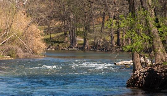
The Guadalupe River is one of the most important and well-known rivers in Texas, stretching about 230 miles across the south-central region of the state. Starting in Kerr County, the river is formed by the meeting of the North Fork and South Fork Guadalupe Rivers. It flows southeast through the Texas Hill Country before eventually emptying into San Antonio Bay on the Gulf of Mexico.
As it winds its way through Texas, the Guadalupe River passes through several cities and towns, including Kerrville, New Braunfels, Seguin, Gonzales, and Victoria. Along the way, it supports both the environment and local communities with water, recreation, and economic benefits. In many of these cities, the river is a central feature of daily life and an attraction for visitors.
The Guadalupe River is especially popular for recreational activities. In summer, thousands of people flock to New Braunfels to enjoy tubing on the river’s cool, clear water. It’s also a top destination for kayaking, canoeing, and white-water rafting. Fishing is another big draw, especially since the river is regularly stocked with rainbow trout. These activities support local tourism and provide an important source of income for businesses in the region.
The natural setting of the Guadalupe River makes it particularly beautiful. It flows through the Texas Hill Country, an area known for its limestone cliffs, dense oak forests, and rolling hills. The river is fed by springs from the Edwards Aquifer, which help keep the water flowing even during dry periods. This spring-fed system also helps maintain clear water and supports a rich ecosystem of plants and animals.
However, the Guadalupe River also has a dangerous side. It flows through a region often called “Flash Flood Alley” because of its steep terrain, shallow soil, and unpredictable weather. These conditions make it one of the most flood-prone areas in the United States. Heavy rains can quickly turn the river into a raging torrent, causing floods that rise within minutes and sweep away anything in their path.
Throughout history, the Guadalupe River has been the site of several deadly floods. Notable disasters occurred in 1998, 2002, and most recently in 2024, when sudden flooding caused widespread destruction and loss of life. In these cases, fast-rising water overwhelmed homes, roads, and camps near the riverbanks. Rescue efforts were often made difficult by blocked roads and ongoing weather conditions.
To manage these risks, the Guadalupe River is regulated by several agencies, including the Guadalupe-Blanco River Authority. One of the key features used to control flooding is the Canyon Lake Dam, located on the upper part of the river. This dam forms Canyon Lake, a reservoir that helps control the river’s flow and stores water for supply and recreation. The dam is crucial for flood control but can’t always prevent disasters when storms drop large amounts of rain in a short period.
The river also holds deep cultural and historical value. Long before European settlers arrived, Native American tribes lived along its banks. Spanish explorer Alonso De León named it Río Guadalupe in the late 1600s after Our Lady of Guadalupe. Since then, it has played an important role in the development of Texas, providing water, transportation, and recreation for generations.
Today, the Guadalupe River remains a symbol of both natural beauty and power. It brings life to the regions it flows through but also demands respect due to the dangers it can pose. Efforts to protect and manage the river continue, as Texas communities seek to enjoy its benefits while preparing for the risks it can bring. The balance between nature and safety remains at the heart of the Guadalupe River’s story.


